Leadership in Palestine
القيادة في فلسطين
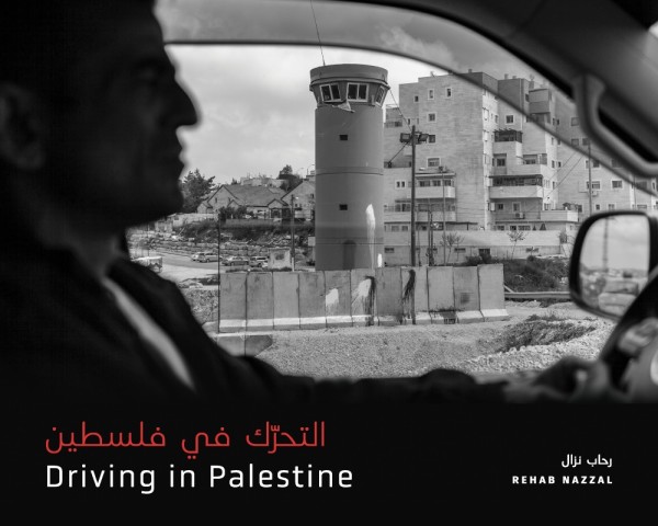
Over the past seven decades, Palestine has been isolated from the Arab world and divided into fragmented and encrypted areas: the 1948 Area, the 1967 Area, Jerusalem, the West Bank, Gaza, and Areas A, B, and C within the West Bank. Each area is governed by different laws, including different roads and permits that control the movement of Palestinians and give privileges to Jewish settlers. “Driving in Palestine” is a creative research project by acclaimed artist Rihab Nazzal, who explores visual indicators of the politics of mobility that she encountered first-hand while traveling in the occupied West Bank between 2010 and 2020. This photo book consists of 160 black-and-white photographs, hand-drawn maps, and critical essays in Arabic and English written by Palestinian and Canadian scholars and artists. All photos were taken from moving vehicles on West Bank roads. It focuses on Israel's movement-restricting architecture and surveillance structures spread throughout the West Bank, including the apartheid wall, separation walls surrounding illegal settlements, gates, fences, watchtowers, barriers, military checkpoints, and other obstacles to freedom of movement.
Bibliographic Data
| Publisher | Fernwood PublishingWebsite |
|---|---|
| Publisher Address | info@fernpub.ca |
| Country | Canada |
| Also In | |
| Published | 2026 |
| Language | Arabic (AR) |
| Pages | 200 pages |
| Edition | first |
| Dimensions | 14.53 x 2.34 x 21.67 cm |
| ISBN | ISBN: 9781773635934 |
| Translation | Translated |